Day trip to Boyagin Rock

As you may remember, I’ve got this foolhardy romantic notion of doing crazy motorcycle adventures.
Well, to do this, I need practice (and fitness – it’s very tiring riding motorbikes off-road) and also to get my bike setup. So what better way to find out how unfit both myself and my bike are for this than to go on a marathon day ride out into the big empty yonder.
I’d spent a little while planning this out, pouring over Google Earth trying to piece together dirt roads and tracks to get to this place. I’d made a track and exported to my phone’s GPS app (OsmAnd+ on Android). The bike was ready, I was ready.
It 6am, Sunday morning, my alarm went and it was time to go.
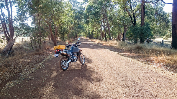
Firing up the mighty DR650, Boyagin Rock and Brookton here we come.
I’d managed to string together 153km of dirt tracks with less than a few km of tarmac necessary to join trail sections together.

I rode up quiet roads to Serpentine and got a bottle of lemonade to compliment the 2l of water I had in the back, added some crisps and a full tank of fuel – good for 400km+ if necessary, then I hit the dirt.
First a stop at Balmoral Rd picnic spot (which looks very unused) for a well earned break, snack and drink. I’ll later wish I’d bought a load more food!!


Carrying on down towards Mt Solus on fun, underused dirt roads, I saw plenty of kangaroos, doing their morning thing – they’re always a little disconcerting if they cross right in front of you because there is one, there are usually a lot more! The adult ones seem pretty large when they leap out from right next next to you!
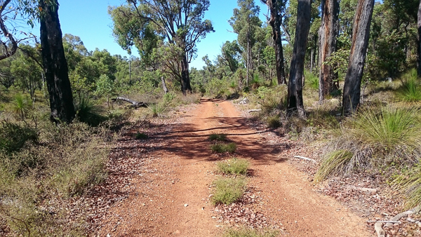
Crossing Solus Road, I’d found an old logging road on Google Earth – it was partially marked, but I had traced out the red dirt path on the screen to join up these two sections of forest that are otherwise cut by that cursed Alcoa bauxite mining. As it turned out, this was probably the most fun section on the whole trip – it was mostly packed dirt not marble like gravel (which is so sketchy to ride on that you can never settle completely and often have those ‘oh shit’ sliding or massive bar wobble moments) and it was tight, twisty and clearly very underused. Awesome.
There were many trees down across the track, showing it’s disuse.
I was a little surprised to round a corner and be faced with an old wooden bridge (but with modern signs – from logging days) – I tested it out and it seemed fine, but it had been reinforced with some big jarrah beams for larger vehicles. I blasted across – my little DR and I weighing in at maybe only 270kg all up would be nothing compared to a car.


I passed through an area that I think might be off limits – I think it’s a dieback protection zone, but it was hard to tell as I couldn’t read the faded signs. I figured I’d keep to the tracks and it would be fine, especially as in summer theres a lot lower risk of carrying anything. There were a load of bee hives in several spots, so clearly this section was used more widely than where I had just come from, although the tracks were very rutted and sandy.
I nearly stacked it after coming over a blind crest and finding the section was rutted out and rock. Luckily I just kept it pointed straight and kept on the gas, rather than panic like I did at Mt Solus, when I came off rather badly a month ago. I was cursing myself, because I think I was just cruising comfortably along when I should have been paying attention.
Lesson learned, on I went. There were lots of sandy sections and I’m not very good in sand. I’d heard speed is key, so I just kept the power on and sailed over the top. Phew.
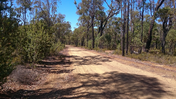
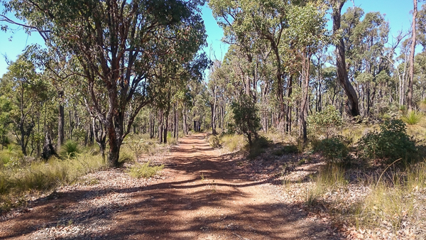
Further on, the woodland started to change from the close packed Jarrah to a more open Eucalypt woodland – dominated by these pale barked trees with open grass underneath. Beautiful. The roads were wide and largely good quality, but still lots of that cursed pea gravel, which when combined with corrugations, was a nightmare to maintain speed.
I was being very cautious as there were a lot of kangaroos around (as it was still early-ish) and I’d often glance over to see a family bounding away through the trees. I’d often spot them as person sized shapes on the road up ahead and as I got closer, they’d spring off – dragging tens more from the surrounding bushes. I also saw a couple of families of emu too – they are so fast and flighty and large enough that I was being very watchful.


The forest parted way suddenly and gave way to the open farms and fields of the beginnings of the Wheatbelt. Was beautiful riding through here and even though I was more than 3/4 of the way there, I still had not seen a single other person.


I pulled over to check the GPS and also to have a well earned drink. It’s at these moments where I need a camping stove to brew a cuppa.


I pushed on down more farm roads and tracks until I came out at the entrance to Boyagin Woods. It’s a gorgeous remnant Wandoo forest, which apparently has echidnas, wallabies, bilbies and numbats – all quite rare and hard to spot. I loved the tracks through here – the white grey bark on the trees was light and made the this part of the trip properly lovely.

Soon, I turned off to Boyagin Rock (helpfully signposted – wouldn’t have spotted the track otherwise)
It was deserted – surprise! (it is out in the middle of nowhere!) I locked my bike up, ran a cable through my jacket sleeves and locked that to the bike, locked my helmet to the little helmet lock (just in case – would be very easy to steal stuff if there’s no-one there), grabbed my camera and water bottle and set out to walk to the top.
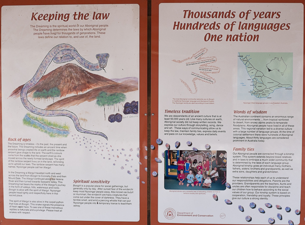
Apparently the place has significance to local Aboriginal culture – I can see why, it really is beautiful, surrounded in dense woodland.
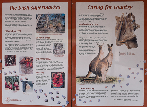
Theres a little information board thingy in a hut at the edge of the picnic ground.


I started the climb to the top. Bear in mind that was wearing stiff, tall dirt-bike boots – although good protection from the rough and tumble of riding (and snakes), it meant this climb was pretty painful on my shins and ankles due to the lack of flex.
You have to climb it in 2 stages, up one exposed granite section, through some bushes and then scramble up the main peak to the top.
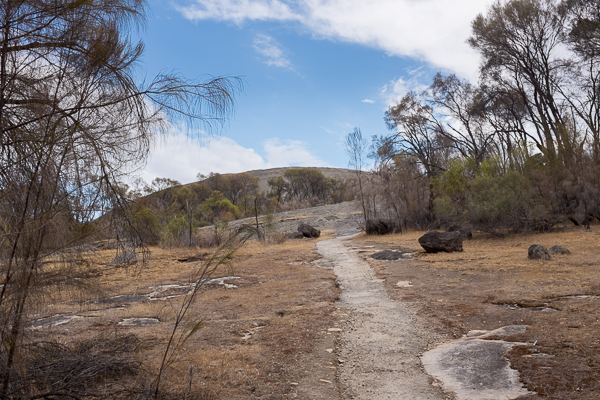


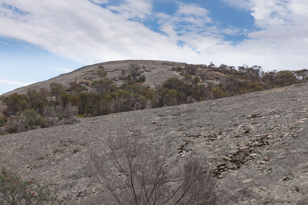
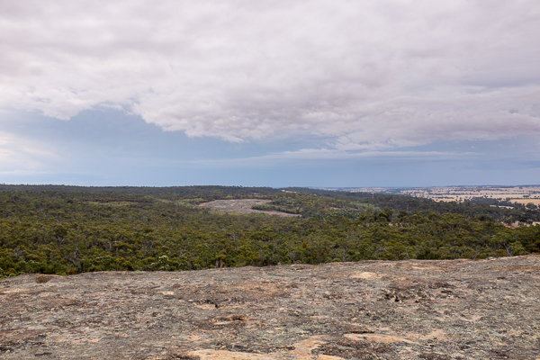
Made it! The views were amazing across the countryside and out across the wheatbelt towards Brookton and beyond.

Some amazing facts about this little hill.
1. The rock is a granite – part of the Yilgarn Craton – an ancient piece of the earth’s crust that hasn’t been recycled or lost.
2. The rock is around 2.6 billion years old.
3. This kind of exposed dome shaped granite hill is called a bornhardt inselberg
4. It’s thought to have been exposed at the surface since Cretaceous times – which means it’s been eroding away since the age of the dinosaur extinction event 60 million years ago. To compare – the Chalk in the UK (white cliffs of Dover) is of the same age and thats been squashed, turned into rock, folded and uplifted and eroded away in the same time period as this hill has stood here. That’s the Yilgarn Craton for you.
5. The Perth basin is filled with material that has eroded off the edges of the ancient granites.
6. Aboriginal people wont stay here at night as they believe little hairy smelly screeching creatures come out and put them in a trance. As such, camping is forbidden.
Can see the rain the distance – apparently what I could see were the fringes of large storms which caused damage and flash flooding a few hundred km away. Yikes!


Looking west in the broad direction of home (and the clear skies), more than 180km away.

It’s hard to see here, but the sky was closing in from the north – there were large bands of rain visible, sweeping across the plains in the distance.
There were also, worryingly, very loud rumblings of thunder echoing across the hills. I hoped I wasn’t going to get wet!
Yours truly, hot, sweaty, dirty and tired but having a ball!!

One final picture and then it was time to head home.


I actually decided to ride into Brookton, another 25km down more dirt roads (although these were bloody great dirt boulevards!) so I could get some more water – I had fuel, but I was worried that if I broke down for any reason, I only had 1/2 a bottle of water left. I filled up for good measure, thirst quenched with some sugary fanta and a small cake for energy, I rode off home – stopping first at the lookout to the west of Brookton for a view out over the wheatbelt and darkening skies, before turning back to the dirt roads and riding back towards blue skies and (mostly – I missed the turn for the end of one of the trails and spent a few minutes on the Albany highway before pealing off down Solus road) the way I had just come.

I ended up getting home around 4pm, tired, dirty and very definitely full of the scent of adventure.
Later, this happened. I love this part of the world!

Great fun!
What I need now is a tank bag for bits and bobs, a GPS mounted to the bike, a windscreen, a larger soft rear bag and a camping stove for trail side cuppas!
